

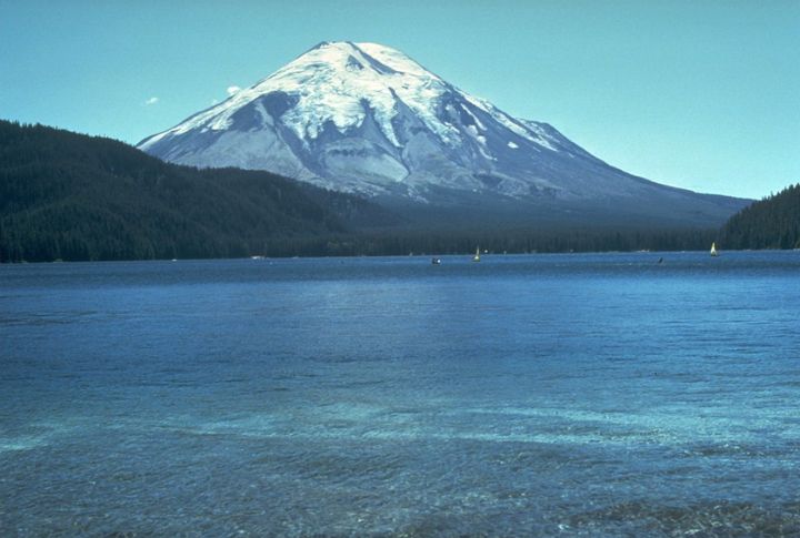
Few natural disasters have been documented as thoroughly as the Mount St. Helens eruption. When the volcano blew in 1980, photographers captured moments that would define a generation’s understanding of geological fury. The images reveal both devastation and surprising recovery in ways words simply can’t convey. Each photograph preserves a piece of that chaotic day and its aftermath. Let’s walk through the visual timeline that changed everything.
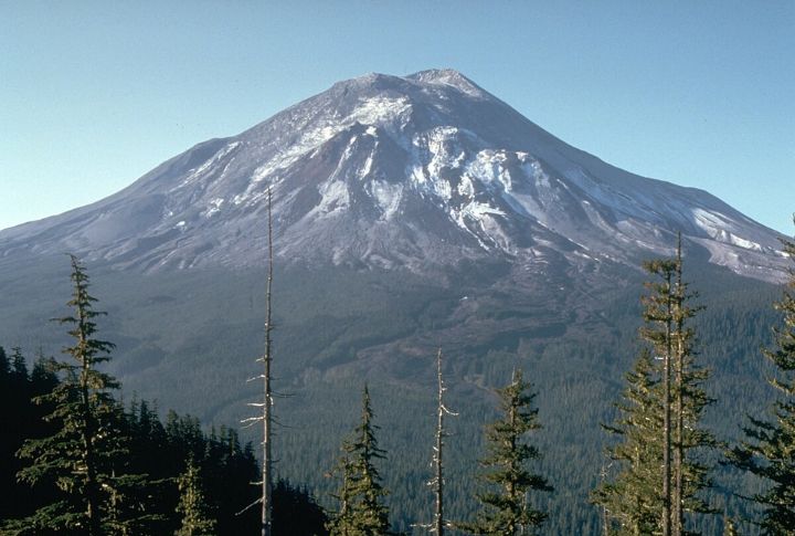
The Calm Before The Cataclysm
A year before the deadly eruption, Mount St. Helens looked calm and peaceful, covered in white snow. This photo from the U.S. Geological Survey shows no sign of danger. Yet deep inside the mountain, pressure was already building—a quiet warning before the violent explosion that would soon follow.
The First Signs Of Trouble
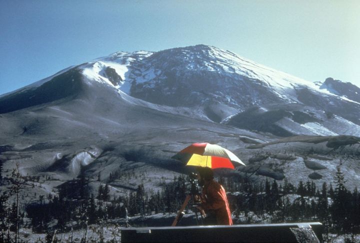
Back in early 1980, scientists noticed something strange; the north side of Mount St. Helens was bulging outward, like the mountain was slowly puffing up. Peter Lipman’s photos made it clear that magma was pushing from inside. That growing bump was nature’s way of warning what was coming next.
The Blast That Shook The Sky
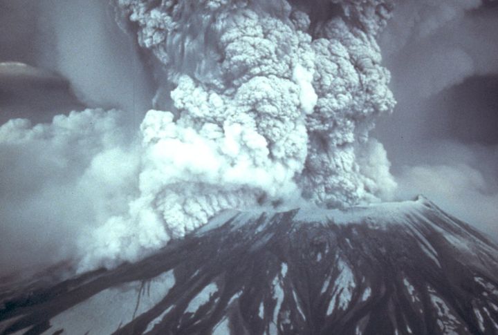
On the morning of May 18, 1980, at precisely 8:32 a.m., Mount St. Helens erupted with staggering power. Photographer Austin Post from the U.S. Geological Survey captured the moment the north side of the mountain collapsed. Hot gas and ash burst out faster than sound, and within seconds, the mountaintop completely disappeared.
The Lateral Blast Unleashed
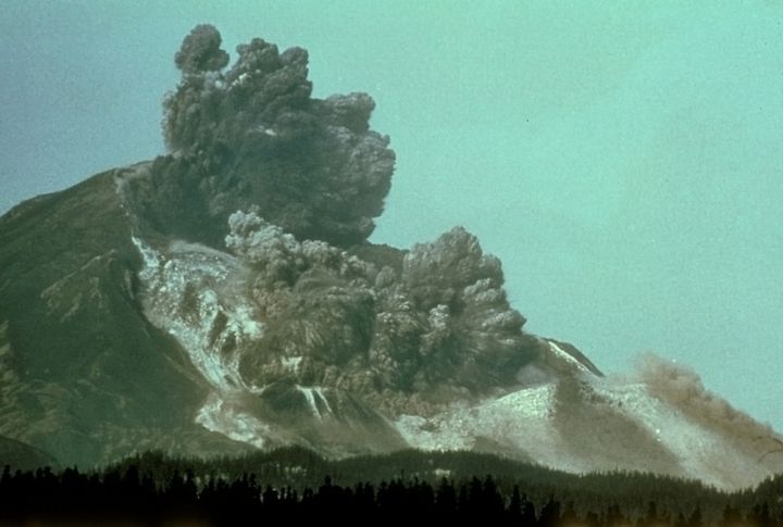
Rare photographs captured the extraordinary side explosion that devastated the region. Instead of erupting upward, Mount St. Helens blasted outward, flattening over 200 square miles of forest within minutes. Trees snapped like twigs, and entire hillsides vanished beneath walls of searing ash and rock—a breathtaking display of nature’s violence.
A Mushroom Cloud Over Washington
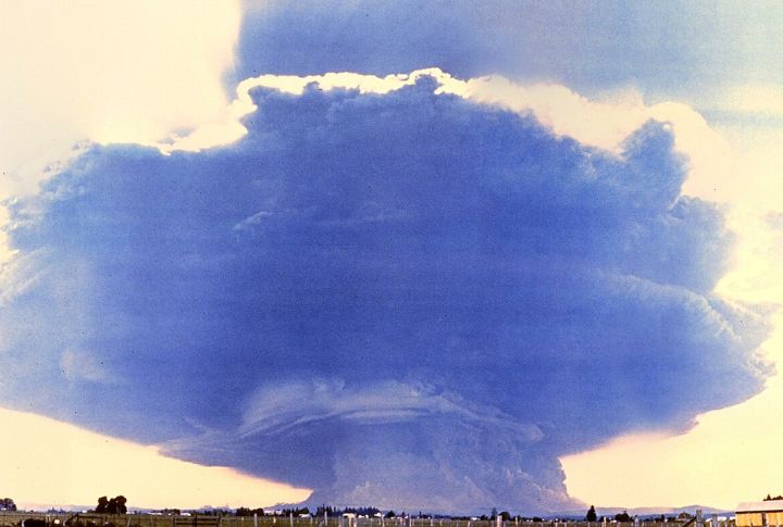
Right after the eruption, people looked up and saw a massive cloud rising higher and higher, which was almost 80,000 feet into the sky. Rocky Kolberg, a photographer, snapped the moment the cloud rose and spread into a giant mushroom shape. Ash drifted for miles, thereby turning day into night and covering towns in thick gray dust.
Ash Falls Like Snow
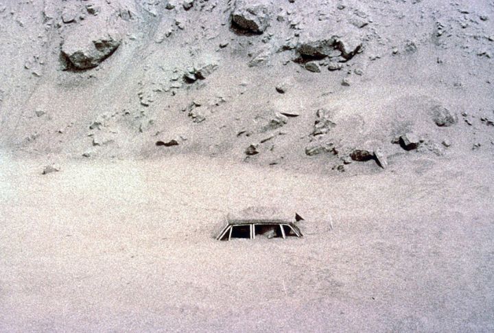
In haunting stillness, towns like Yakima lay buried beneath volcanic ash. Photographs from the U.S. Forest Service show cars, streets, and rooftops blanketed in gray. The air grew muffled, and footsteps left ghostly prints in the dust. It looked like winter, but the snow was ash—cold and suffocating.
The Ghost Forest Of Mount St. Helens
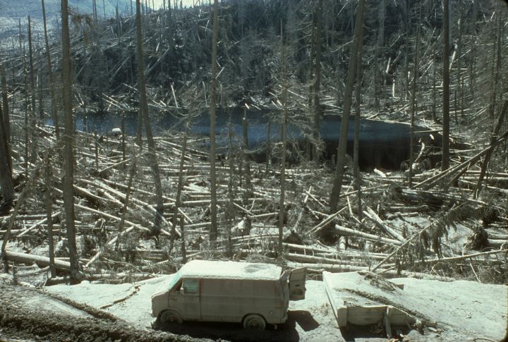
The eruption’s blast transformed thriving forests into fields of ruin. Thousands of trees lay strewn like matchsticks, their trunks pointing in one direction, the path of destruction. In U.S. Forest Service photos, even vehicles lie crushed among the debris.
Evacuation And Aftermath
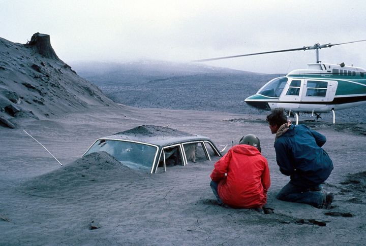
After the eruption, rescuers moved carefully through thick ash and mud that covered everything. U.S. Geological Survey photographer Pete Lipman captured broken cars, fallen bridges, and destroyed homes. The once-familiar surroundings looked unrecognizable; however, survivors kept pushing forward and showed incredible courage in the face of total destruction.
Scientists At Ground Zero
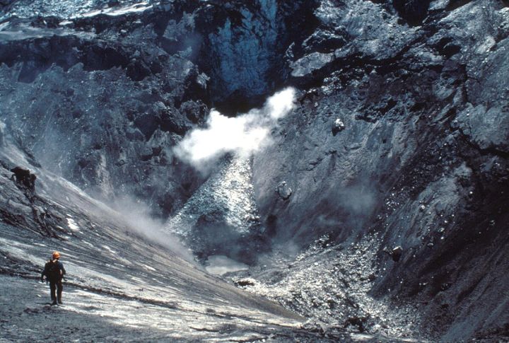
Researchers like Dave Johnston ventured into the volcano’s scarred crater to study what remained. Their work documented the formation of new lakes, fumaroles, and early regrowth. Each photo captures the bravery and curiosity of those who returned to study the volcano’s aftermath.
A Monument To Renewal
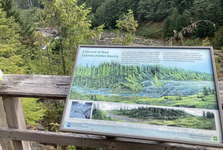
Two years after the eruption, Mount St. Helens was protected as a National Volcanic Monument. The goal was to let nature heal on its own. Today, Forest Service photos show new trees and plants covering the land. Inside the crater, a lava dome slowly grows, proof of nature’s recovery.